
Soon I looked a castle over the town. I felt that I had to come to this castle. You have to know that footpath through Coburg is not signed. So hiker has problem that he or she finds the right footpath which you lead to first sign out of town.

I started to ask people where I was able to come to the airport. I saw on the map that footpath E6 went past the airplane. My German language is not very well, so I had the problem with communication with people. But I got information by them where I had to go. Maybe I could find the shorter footpath. However first I went up the hill cross the many nice houses.

Finnaly I came to park. There I also asked the one guy where was the airplane. He told me that I had to go toward the castle which I saw on the top of hill.

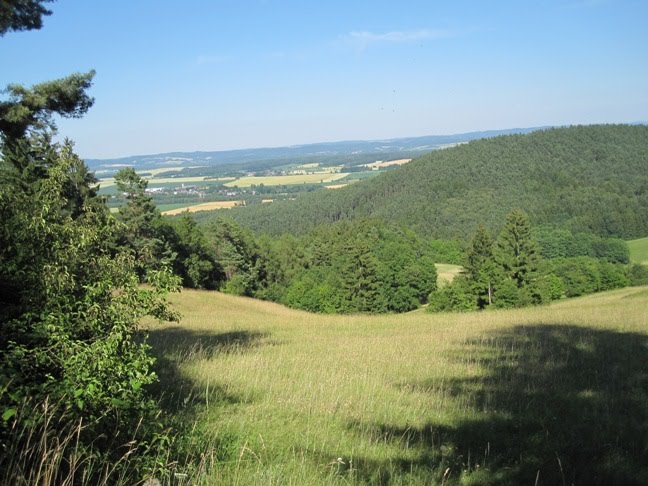
After 30 minutes I came to the castle. It was really the big and the nice castle. I looked around the castle but I didn't enter in the castle. I am sure that you can see a lot of thing inside of castle. On the top of castle you probably have a beautiful panoramic view of the surrounding.

Under the castle I saw first time the signs of German E6 footpath in this area.

I started to follow the signs. They led me first to the airport.

Now I started to walk along forest, meadows, fields and in the near of motorway that I finnaly came to next village named Neu und Neershof. There was also small lake.

Here I started to walk along forest which has shape of rolling hills. Their heigh was about 450 meters the most.

Of course, I also crossed the villages between forests. There I was able to see some monuments which they built in memory of the victims from the 1. and 2. World War.

I liked the seats which was on the some places by footpath. You can rest there.

The noticeboards about nature like birds, forests etc. were set up by the footpath too.

When I came on the top of hill named Birkiger Berg 484 meters I was abble to see a new landscape. It had a very elongated hills which were overgrown with forests. Between hills were cereal fields and meadows.
Before me was the next hill named Fürhterd berg 420 meters. I didn't have any water or other soft drink, so I became dihydrate. I was very happy when I came in village Fürth am Berg and I saw a pub. I known that I would able to get a soft drink. The footpath go up sharply to next village named Plesten after Fürth am berg. I was able to admire the nice noticeboards about forest beside footpaths. We called this type of way: forest learn trail.

Before me was the last slope this day. It was Hassenberg and was 433 meters high. I finnaly came on the top of this hill.

When I descended into the valley I was near of Mitwitz. The name of village was Steinac.

When I was approaching to Mitwitz I able to see that I came in other landscape name Frankenwald.

There I ate, drank and slept in very good hotel named Wasserschloss. My plan for the next day was to go from Mitwitz to Nordhalben.

The next day I went first through town Mitwitz. If you want to buy something for drink, eat etc., you can do that in oil station or supermarket which are along E6 footpath.

First I went through the forest where I able to see some ponds. I was surprised when I came in village Bachlein because I saw hotel and pub there where was a lot of people in Saturday morning.

Now I started to go up to Gundelsdorf. I walked along roads, forest trails a long time. Finnaly I came to Gundelsdorf which had a rail station and a football club.

Near of Gundelsdort was next village along trail named Glosberg. There wait hikers a next long hill which lead he or she to Gifting and a nice church too.

In the middle of this hill I saw a meadow where they didn't use the fertilizers.

Some steps away I saw very inovation way of sign. They used a container where they put the signs of trails which go there.

I walked long a time when I came in Gifting before pub which was closed around 12 p.m.

Here I started to walk along a long valley between 2 hills which were owergrown with forest. It has to be long minimum by 10 km to 15 km.

On the begin this part of way I met the bicyclists.

You walk all the time along a rivulet named Doberbach. Can't cross rivulet if you don't have a bridge. You can miss the trail if you do that.

In this part of way you will cross a lot of bridges.

Finnaly I looked the camp what meaned that I would start to go up to Nordhalben.

This place is named Effeltermühle. In camp they have guests but you don't buy eat or drink. So I got by male the orange juice for free. He didn't want that I paid him the juice.

Here you have to be very careful if you want to quick continue the way. First you have to follow the sign which show up to hill where is village Effelter. But when you will see the pond on the right side of walk you have to go right although there is not sign. Signs are in the forest again and trail is sign with strips too. Look the below picture.

If you will miss this direction you can happened that you stay in gasthof in Effelten named Puzelt, especially if you walk before dark.

From Effelteren mühle to Norhalben hikers have the hardest part of way from Coburg to Marktredewitz. I went to go up a long time that I came to Tschirin. Forest was all the time around me. After that I walked a long time on the top of forest and for end I had to climb to Nordhalben. I needed for this part of trail minimal 4 hours.

When you come to Nordhalben you can get for sleep, for example in hotel Post. There is very good for eat, drink and sleep.

My next stage was Nordhalben-Helmbrechts. I started to walk early in the morning. In the Nordhalben was the rare people on the street. I admired a nice church in Nordhalben.

Below of village I went cross the wood houses. You can see also the other intresting buildings in Nordhalben.

My first village after Nordhalben was Stoffelsmühle. There I started to go up in forest again.

I went from one peak to other peak in direction of Schvarcenbach. Sometimes I came to motorway or some small village. I walked also along very bad trail which overgrounded with the big grass.

I went also past the small wood object where you can sleep if you want without money. But some steps below you have to be careful again. The arrow which shows the right way is turn on the wrong side. It have to be turn for 180° that it shows the right side.
Finnaly I came after about 5 hours to Tiemitz which is small village with pub.

When I went over the other peak I came to village Sorg which is bigger as Thiemetz. There you have to go along steep slope with asphalt and you come to other village named Maierhof.

When I came on the place with a view after Maierhof I was able to see town Schwarzenbach.

When I overcame a hill before town I entered in its. There is trail good sign that you can easy come out of town towards Helmbrechts. On the end of town is good supermarket where you can buy what you need.


On the margin of town I was able to admire a facade of house which was made of some kind of brick. You can see some houses with this type of facade where I hiked. I liked them.

After Schwarzenbach is popular hill named Döbraberg. There is tower and nordic walking trails.


When I climbed on the tower I was able to see all around.
On this area trails for nordic walking are signed very well.

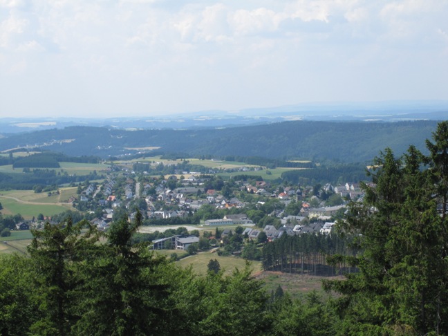
I was walking through the forest until I came in the next settlement. When I came in its, I didn't know if it is Helmbrechts or now. It was the big settlment, so I was confuse. Finnaly I found out that was the Kleine Schwarzenbach.

When I came on the margin of Kleine Schwarzenbach I was able to see in the distance Helmbrechts. I like that I see the next target of my hike.
I was happy that I came in the town because I thought that I would easy to find a bad. But I quickly found out that a lot of pubs and hotels were close. Monday is day when they don't work. I had a lucky because one male helped me to found the bad for me. We searched the room with his car. Finnaly we got the room in hotel Zaitler in centrum of Helmbrechts.

Next day I had very heavely stage from Helmbrechts to Fichtenberg, so I woke up early. First I walked along meadows and forests. I went pass the meadow with horses, field of peas.


When I walked a few hours I entered in the village before Münchberg named Süsenberg. There were a lot of farms.

I was be very close of Münchberg. I went through the forest and I came to the margine of Müncberg. Müncberg was one of the biggest town which I went to visit on my hike from Coburg to Marktredewitz. When you come in this town you have to take direction of sport park where you can find swimming pool, tenis places etc.

When I walked the margine of town I came in the centre of Münchberg. I easy held the right direction because the trail was very good signed all the time.

On the and of Münchberg I was able to see the first time new signs. Until now signs were in shape of blue crosses. Now they were in shape of black Q on the yellow base.

My next target of this stage was market town Zell. First I had to walk some time in the margine of Münchberg. I went also pass a supermarket where I bought something for eat and drink.

When I walked the small forest behind Münchberg I came to small pub named Rußhütte. Before this pub one male was siting and I talked with him some words.

Than I was walking again across the meadows, forests and throught the villages: Mechlenreuth, Schnakenhof. In village named Kleinlosnitz I was able to see from outside: Ober Fränkisches Baurenhofmuseum Kleinlosnitz.

After some hours of walk I came to Zell. Zell is market town under the hill which is stretch almost to Marktredewitz.

After the Zell I started to walk towards Fichtenberg. I known that I would need a long time that I would came to Fichtenberg. I also noticed that I would walk along springs what I was able to read from noticeboards. Soon I came to first of them: Quelle der Saale.

When I walked a long time through the forest I came to pubs named Höllenwolf. It lieds beside asfalt road.

I directed to other spring named Egerquelle. Again I needed some time that I came to its.

This area was higer as areas which I walked until now. The peaks were high around 800meters. So I walked along really mountain ground. In the near is also mountain Schneeberg which is high around 1000 meters.

After the several hours of walk along mountains trail I came to hut named Seehaus where you were able to sleep.

I continued my way toward Fichtenberg see. First from hut I climbed some time. I noticed again the old rockets which lie along the forest. That told me that I came on other area. I was able to see them all the way from Bayerisch Eisenstein to Marktredewitz.

Some kilometers forward I came again to next spring named Weismainquelle. It was near of Fichtelsee.

Finnaly I came to Fichtelsee.

I made the mystake that I didn't sleep in Waldhotel am Fichtelsee.

I was very tired but I had to go in hotel Schönblick where I reserved a room. So I needed one hour that I came in Fichtelberg. And minimal 0,5 hour that I came to hotel Scheeberg which was on the end of village.

The german trail E6 doesn't go to Fichtelberg. It simple continues its direction toward village Nagel from Fichtelsee. So I walked again through the forest that I came in Nagel which had also see named Nagelsee.

I continued my way towards the hill before Marktredewitz. I bought something for eat and drink in bakehouse in Reichenbach.

After that I started to climb on hill Kösseine. When I went on top of hill I started to walk toward Luisenburg where was a pub and some touristic attractions.

I came down from Luiseburg to Bad Alexsandersbad.

I had to walk the last part of my trail from Cobourg to Marktredewitz. First I crossed the old castel.

Under the park a special trail from plates started which led me to forest.

A trail which went through forest led me in Marktredewitz.

Suddendly Marktredewitz appeared.

My hike from Couborg to Marktredewitz was interesting. I liked to walk along meadows, fields, forests, mountain trails which are not dangerous. I had all the time a good weather, so I didn't need umbrella. People were friendly. The pubs offer were fine too. I was able to see a lot of nice houses with nice flowers and other jewels. On the rare part of trail were signs bad. There I had trouble but I solve all of them. I lost only some time.